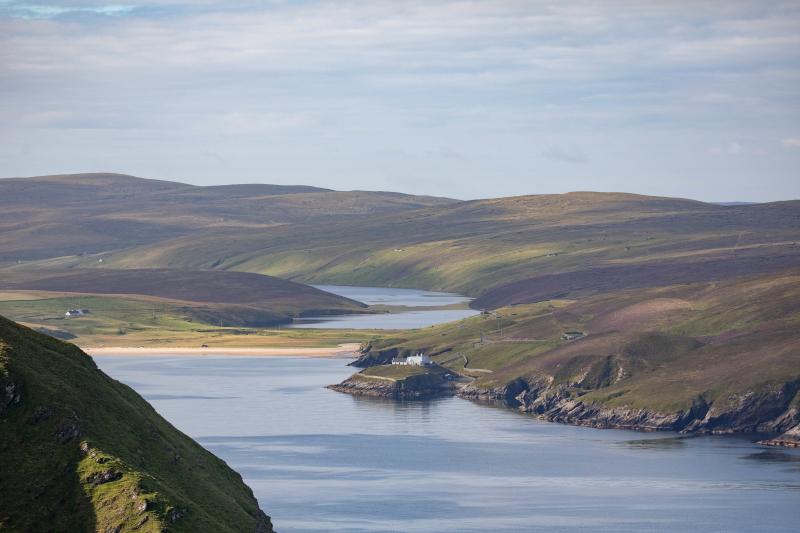
Shetland has long been ruled by happenings in the sky above, as Kirsten Henton discovers on a new trail around the UK’s northernmost isle of Unst.
Rooted between the waves of the north Atlantic and the North Sea is the archipelago of Shetland. Some 100 miles off the north east coast of mainland Scotland, this cluster of islands and skerries marks the northernmost point of the British Isles and, as such, has a magnetic pull for adventure seekers, wildlife watchers, hikers and history enthusiasts.
The islands’ capital of Lerwick on the largest isle of Mainland keeps a busy port and a town well stocked with independent shops, restaurants and local tour operators all working alongside the industries of farming, oil and gas and, increasingly, renewables such as wind, that support the population of around 23,000 inhabitants.
Thanks to 600 years of Norse rule that followed the first Viking footfall in around 850 AD, Shetland has a cultural identity all of its own. Under Danish rule until woven into Scotland in 1469, this heritage is visible everywhere from Old Norse place names to festivals, folklore and traditional Fair Isle knitting patterns.
Its location has ensured its strategic importance for millennia, and activity in the sky above Shetland has long influenced farming, fishing and navigation. It’s perhaps no great surprise then that this historic connection has been channelled into an innovative new Sky Trail to help visitors explore the third-largest and northernmost island of Unst.
Venturing northwards
Travelling north from Mainland, I’m treated to a big, blue sky welcome as I disembark the first ferry at the southern port of Ulsta on the second largest island of Yell. I’m soon swept up in a small, fast-paced convoy of locals and visitors in ubiquitous Bolts rental cars racing for the next sailing to Unst from the northern terminal at Gutcher.
The road undulates across rolling green island of Yell and I slow for skittish lambs not yet road savvy. The 20-minute drive gives me time to ponder what exactly I’m going to be able to see on this trail given that it’s springtime when days enjoy an average of 17 hours of daylight. However, it claims to “showcase the marvels and enormity of the skies, day and night, summer and winter”, so I remain optimistic.
The Wild Skies initiative
At 12 miles long and five miles at its widest, Unst is the titleholder of many ‘most northerly’ accolades from the community swimming pool to the post box. Geographically closer to Norway than Scotland, Unst is further north than Bergen and life on this ocean-dwelling island of 600 or so inhabitants is lived among the elements.
As with the wider archipelago, the sky has always affected everyday life here with the sun, moon and stars all playing their part. The extremes of the seasons, which see lengthy days with ‘simmer dim’ twilight in summer and seemingly endless darkness flecked with constellations in winter, ensure the island is intrinsically linked to the sky.
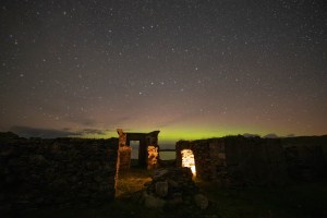
Unst’s reputation as an island in sync with what’s overhead is an evolving saga of the Viking kind, making it a natural place for this new trail. Created by Wild Skies Shetland, an award-winning charitable social enterprise, the Sky Trail was established by volunteers, including seven passionate trustees.
The route consists of 13 panels strategically dotted around the island with a mixture of QR codes, listening posts, benches and viewpoints, all with a specific theme offering the chance to learn something about the sky above you as well as the environment around you.
As Catriona Waddington, chair of Wild Skies Shetland, tells me: “Each one of the Sky Trail’s plaques is in a different place for a different reason. A lot of them have splendid views of wide open landscapes while others are tucked away in little corners, but there’s a reason each panel is where it is.”
Sky Trailing
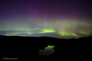
I meet Jane Macaulay, an Unst resident and the brains behind Wild Skies Shetland – who’s now the secretary – at the trail’s northernmost panel. It’s dedicated to the Aurora Borealis close to the peak of the island’s highest hill, Saxa Vord.
The sun may be shining but there’s a strong breeze with mist in the air and I zip my coat up tight while we listen to harp music composed and performed by Unst resident Sunita Staneslow which plays through a speaker on the bench.
It’s somewhat ethereal, the melodic sounds emanating as we look across the Burra Firth with skuas bouncing on the wind and the sandy shores of Burrafirth Beach winking invitingly in the dappled sunlight. Jane muses that “while it’s a fabulous place to sit for the Aurora, it’s not all about night sky; it’s a truly beautiful spot; it’s magical here”. She’s not wrong.
We make our way around the headland to find the next panel at the entrance to Hermaness National Nature Reserve. Jane tells me that “the Hermaness panel is all about storms”.
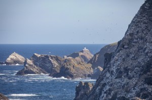
This makes sense as we’re close to the amazing engineering feat which is Muckle Flugga Lighthouse, a dramatic Stevenson construction completed in 1854 perched atop the most northerly point of the UK. With ears close to the speaker, we listen to local resident Tony Mouat share his experience of the hurricane of 1991, during which the island was battered by 197 mph winds, the strongest ever recorded, and two people died.
We turn towards the village of Haroldswick, which couldn’t sound more Norse; with ‘wick’ being the Old Norse for ‘bay’, of which there are many in Shetland. We make a brief stop at the informative Unst Heritage Centre to see the Wild Skies photography exhibition before exploring the life-sized replica Viking ship and longhouse that sit between the main road and the water to the south of the village.
After a clamber around the remarkable wooden ship, I scan the QR code on the Sky Trail panel, which takes me to a short animation detailing how the Vikings, who were expert sky-readers, used the stars to navigate at sea.
From here, we head south to the island’s largest settlement of Baltasound and find the panel in the grounds of Halligarth House. A dilapidated 1830s construction, it was once the home of Dr Laurence Edmonstone, a medical man, naturalist and conservationist who contributed greatly to the subject of ornithology.
Dr Edmonstone also planted the UK’s most northerly wood in the garden here. An excited Jane reveals: “This is the only extensive group of trees anywhere on Unst” and she beams with genuine joy at the bluebells thriving under their protection.
The panel here asks “What shape is the Earth?” in its mission to enlighten us regarding how our understanding of the planets evolved through later centuries thanks to the work of 19th Century scientists.
We detour to the west of the island where we find the Lund plaque on a ruined farmstead and learn about galaxies like the Milky Way. We’re also told how the Neolithic Lund Standing Stone was an early attempt to try and understand the moon. All this is seen while overlooking the white sands of Lunda Wick, where eider ducks bob in the shallows under the watchful eye of the ruined 12th-century St Olaf’s Kirk.
We circle back to the main road via the grassy mounds of a Viking longhouse and Iron Age broch at Underhoull and head to the south east of the island to see what the plaque at Muness Castle has to tell us. Here, in this area renowned for its dark skies, the Sky Trail gives tips for spying meteors, or shooting stars, rightly stating the need to “Be patient. Very patient.”
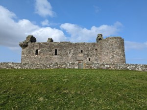
No stranger to remote, underwhelming castle ruins, I have low expectations of – you’ve guessed it – Britain’s most northerly castle, but I’m happily proved wrong; this solid 16th-century structure is instantly impressive. We take the torches stashed behind the information board (thank you, Historic Environment Scotland) and pass through the heavy wooden door, lighting up pitch-black corridors, winding upwards to the towers of what was evidently a fine residence.
Muness Castle pointedly proves that the Sky Trail is not meant to be a stand-alone route. Having traversed the island, I feel a real sense of what Wild Skies is aiming to achieve not by reinventing the wheel but by adding value to existing attractions in a thematic route.
As Jane says when we part after our highly enjoyable day: “The Sky Trail is not about promising people that if they go to this place, they will see ‘that’; instead, it’s about encouraging people to visit an interesting part of Unst and learn a little about a different aspect of the sky there.”
The final frontier
My last adventure on Unst takes me through the solar system. Sort of. Tying in with the island’s impending role in the space industry, Wild Skies has created a Planetary Trail. This tasty bite-sized route is the brainchild of Wild Skies’ Trustee Fabien Kuntz, who accompanies me on the walk.
This mile-long linear route, which skirts the hillside of Saxa Vord beneath the bench where I kicked off the Sky Trail, combines education with an easy-going stroll. A simple track is made spectacular by the detailed boards; the views get bigger and better as you continue around the track’s curved trajectory under the domed gaze of RAF Saxa Vord radar station.
A project with community at its heart, the Planetary Trail encouraged islanders of all ages to help create the boards and share information about each planet. Our first stop, the sun, is depicted in a collage created by children from the local nursery.
Fabien explains: “The idea was to have an experience of the solar system that people could relate to. Numbers and facts can be overwhelming so we wanted to recreate a model of the solar system by keeping all the proportions of the distances between the planets.”
Each metre represents three million kilometres, which, as Fabien muses with a wry smile, means “when you’re walking one metre per second, you’re covering three million kilometres per second and travelling ten times faster than the speed of light; you’re breaking the laws of physics on this trail”.
It takes us from the sun all the way to Pluto (even though “technically Pluto is not a planet anymore”) on a jagged headland where a picnic bench awaits for lunch with views over to Muckle Flugga.
The most important bit? Don’t forget to write in the guestbook kept safe in a plastic box at the beginning/end of the trail. “It’s always interesting to find out who’s been and where they’re from,” Fabien tells me as he expectantly checks to see who last left their mark.
wildskiesshetland.com/; visitscotland.com/
REACHING FOR THE STARS…
The space industry is coming to Shetland. Business is about to boom from the old RAF Skaw site on the Lamba Ness peninsula in the north of Unst when the new SaxaVord Spaceport, one of seven such sites scheduled to open across the UK, five of which are in Scotland, will be used to launch satellites and host an antenna ground station. It’s set to launch its first rocket by the end of 2024. While there’s not much visitors can actually see, the whimsical signs at the site make a good photo op.
FIVE ESSENTIAL STOPS ON UNST

La Petit Cafe
A delightfully incongruous waterfront French honesty shop in Uyeasound run by Wild Skies’ own Fabien Kuntz. Missing your galette biscuits or bearnaise sauce? This is for you.
Saxa Vord Distillery
Visit the UK’s northernmost distillery (naturally) for an entertaining tasting of Shetland Reel Gin. See the hard-working still, sniff botanicals and take a bottle home.
Victoria’s Vintage Tearooms
Refuel at this waterfront cafe in Haroldswick. Choose from crafty souvenirs before ordering a cosy-clad pot of tea, homemade soup, cakes and scones. Ice cream optional.
Bobby’s Bus Shelter
Named after schoolboy Bobby McCauley who sought a shelter to wait in, the stop has turned into an attraction in recent decades with chairs, dress-up and a different theme with props each year.
MELLA handmade soap and candles
Look out for these distinctively stylish Unst-made products, especially the wild swimming balm. They’re sold Shetland-wide, including at the Unst Heritage Centre.
WHERE TO STAY

For a stay to remember, check in to Belmont House where you’ll receive a very warm welcome from the owner and former policeman Martin Wilson and Rufus the retired police dog.
Rooms at this imposing yet beautifully restored Georgian property are comfy, cosy and, much like the house, characterful, while meals cooked by Martin are enjoyed in the traditional dining room. Relax with a book in the first-floor lounge or, if needs must, work at the stately desk with the most distracting of sea views.
The house sits just up from the island’s ferry terminal as well as Unst’s southernmost Sky Trail panel, which details the moon’s power over the tides.

